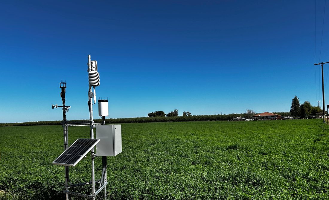
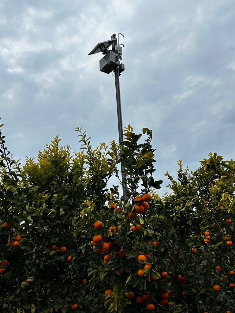
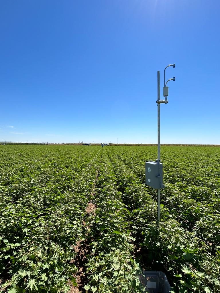
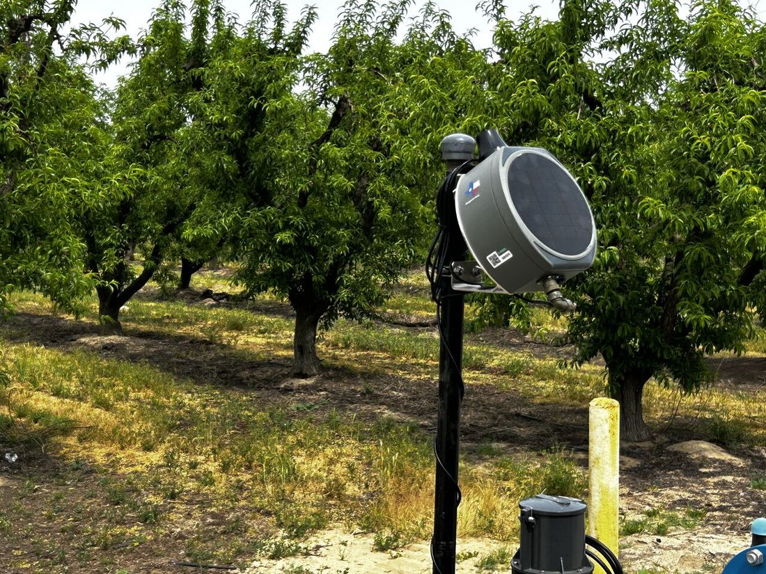
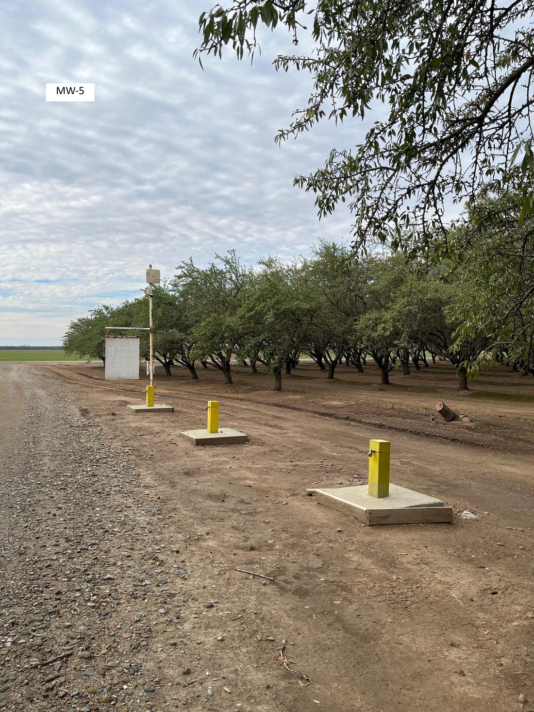
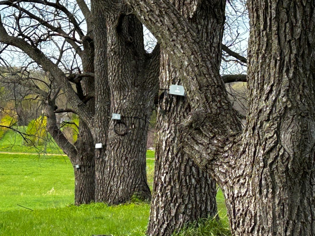
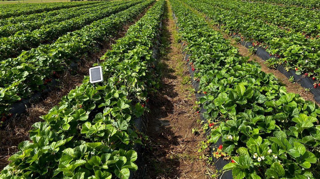
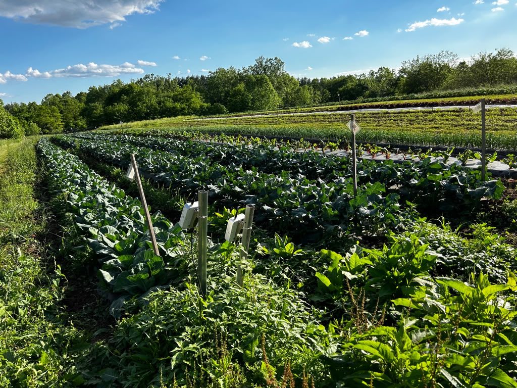
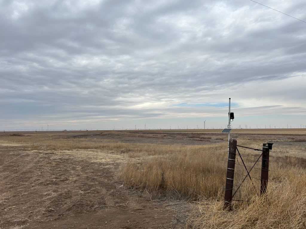
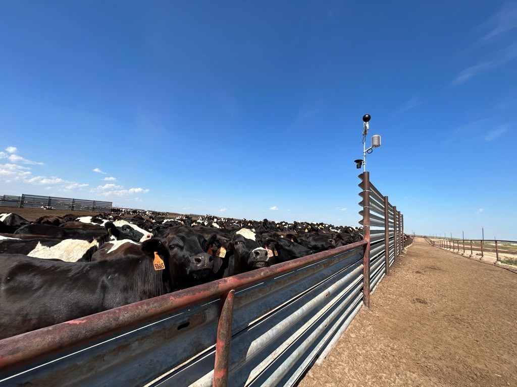
Water · Agriculture · Resource Conservation

Water Intelligence — From Ground Truth to Action
Monitor Water. Verify Use. Optimize. Defend.

From the sensor in the ground to the decision on your desk, we turn water monitoring — groundwater, surface water, irrigation, and livestock water — into answers you can act on: what's happening, and what to do next.

Field sensing, flexible wireless connectivity, and cloud software to manage the data, run the analytics, generate reports, and automate control, delivered end to end.

Deployed on working Farms, Ranches, and Districts — from California's Central Valley to the Texas Panhandle, the Midwest, and the Mid-Atlantic.

Flowmeter Telemetry· Groundwater Monitoring· Weather & ET· Lagoon & Pond Levels· Irrigation Decision Support· Surface Water & Conveyance

End to End

From Sensor To Report — One Complete Solution.

Woodpecker delivers the entire monitoring solution as one integrated system — the sensor in the ground, the connection back, the processing in the field, the analytics in the cloud, and the reporting and workflows on top.

Instrumentation

Field-grade sensors and devices that capture what's happening at every well, field, and asset.

Communications

The right connection for each site — private long-range wireless, cellular, satellite, or Bluetooth.

Edge Intelligence

Local processing and automation in the field, so sites keep working without a constant connection.

Cloud Analytics

Iris Central turns field data into a structured, defensible record — with reporting, alerts, and an open API.

Operational Workflows

Alerts, compliance reporting, water accounting, and optimization built on top of the record.

How It Connects

The Right Connection For Every Site.

Most vendors make you adapt to their one wireless technology. Woodpecker designs the network around your operation — using whatever keeps each asset reliably connected, even where cellular coverage is poor. You don't manage radios; you get data you can count on.

We adapt the communications to your operation, not the other way around. The field hardware underneath is built for long deployment cycles and multi-year battery life — and for the engineers and integrators who want the specifics, the model, radio, and API details live on the specifications page.

View technical specifications

Private long-range wireless

High-density monitoring across large properties — wells, weather, soil, and flow.

Cellular

Where coverage is available and added bandwidth helps.

Satellite

Remote assets beyond the reach of any local network.

Bluetooth

On-site commissioning, configuration, and service.

In The Field

Deployed Across Crops, Climates, and States.

From row crops and orchards to rangeland, groundwater basins, and feedlots — Woodpecker systems run on working farms, ranches, and districts from California's Central Valley to the Texas Panhandle to the Midwest and Mid-Atlantic. Hover to pause · tap any photo to enlarge.

Weather Station - Kerman, CA
Weather Station — Kerman, CA
Citrus Actual ET - Reedley, CA
Citrus Actual ET — Reedley, CA
Cotton Actual ET - Bushland, TX
Cotton Actual ET — Bushland, TX
Irrigation Flowmeter - Atwater, CA
Irrigation Flowmeter — Atwater, CA
Monitoring Wells - Stevinson, CA
Monitoring Wells — Stevinson, CA
Walnut Sap Flow - Chaska, MN
Walnut Sap Flow — Chaska, MN
Strawberry Soil Water - Marietta, OH
Strawberry Soil Water — Marietta, OH
Organic Vegetables - Dickerson, MD
Organic Vegetables — Dickerson, MD
Precipitation Gauge - White Deer, TX
Precipitation Gauge — White Deer, TX
Cattle Heat Stress - Dalhart, TX
Cattle Heat Stress — Dalhart, TX

For Water Agencies and Districts

Build The Monitoring Backbone Your District Runs On.

From basin-wide groundwater agencies to local irrigation and water districts, we design, deploy, and operate the field networks that turn basin and conveyance reality into a record you can act on, file with, and claim credit against.

Basin and District Monitoring Networks

Wells, surface diversions, conveyance, and weather observed as a unified network — at the scale of a basin-wide agency or a single water district managing its own canals and groundwater wells. Engineered as one system, not a patchwork.

Field-Grade ET and Precipitation Observations

Where regional satellite-derived ET estimates miss precipitation reality on the ground — particularly in the microclimates inside your basin — we put instrumentation in the field to ground-truth the numbers your sustainability plan and operating decisions depend on.

Conveyance Characterization and Recharge Accounting

Quantify canal seepage, conveyance losses, and incidental groundwater recharge — so districts can claim the recharge credits their infrastructure already produces, allocate shares fairly, and document basin contributions with field data instead of estimates.

Defensible Data for Filings, Allocations, and Claims

Auditable records for sustainability plan reporting, state board filings, recharge credit accounting, and the allocation and enforcement decisions that get contested. When stakeholders or neighboring interests question your numbers, your data is ready to speak for itself.

For Growers

Run The Operation Smarter.

You already know your fields. We give you the instrumentation to monitor what matters, optimize where it counts, and automate the routine — so every decision you make is grounded in what your fields actually show.

Soil, Plant, and Weather Instrumentation

Soil, plant, and weather sensors — the field-specific data layer underneath every irrigation and operations decision.

Irrigation Optimization and Water-Use Efficiency

Refine irrigation timing and volume using field-specific soil, plant, and weather signals — to save water, lift yields, and replace regional averages with what your fields actually show. For operations where irrigation is an economic decision, not just a compliance one.

Operational Automation and Flowmeter Compliance

Tie monitoring directly to valve and pump control — schedule, trigger, and adjust without driving the perimeter — with flowmeter compliance built in where GSAs and water districts mandate it.

What We Deploy

One Platform. The Deployments That Matter.

Modular hardware, connectivity, and cloud — configured for the specific monitoring jobs water agencies, growers, and dairies actually need done.

Groundwater Monitoring Networks

Well-network deployments for GSAs and groundwater conservation districts managing basin sustainability across their jurisdictions.

Surface Water & Conveyance

Diversion measurement, canal flow, and seepage characterization — for irrigation districts, small water districts claiming recharge credits, and rights holders filing with state boards.

Weather Stations

Field-grade precipitation and ET observations where regional satellite estimates fall short.

Irrigation Flowmeters

Compliance-grade flow monitoring for GSAs, water conservation districts, and grower reporting.

Soil Sensing & Irrigation Advisory

Soil, plant, and weather sensing turned into crop-specific irrigation advice. Iris Central blends sensors with on-site ET and crop coefficients to recommend per-block run times for almonds, pistachios, blueberries, silage corn, and more.

Lagoon & Pond Monitoring

Continuous lagoon and storage-pond levels with freeboard alerts for dairies — capacity tracking and records for Nutrient Management Plan and Waste Discharge Requirements reporting.

Most Ag-tech Tells You What To Do.
We Make Sure You Can Prove What You Did.

Whether you're allocating water across a basin or defending a single farm's record, the value isn't in dashboards — it's in having the right data, captured correctly, when the answer matters.

Our Platform

Iris Central — Where The Field Comes Together.

The cloud platform where Woodpecker solutions are delivered. Whether you're running a basin-wide groundwater network, an irrigation compliance program, a recharge accounting workflow, or a multi-site farm operation — the application you use lives in one consistent operator experience.

Field data, role-based access for districts and operators, configurable reporting and alerts, and an open API for your downstream client applications. The analytics layer underneath grows from baseline monitoring through advanced modeling — without the data ever leaving the record.

Talk to Us About Iris Central

Multi-Solution Platform

Groundwater networks, flowmeter compliance, recharge accounting, irrigation operations — every Woodpecker solution lives in one consistent operator experience.

Configurable Reporting & Alerts

Outputs matched to your obligations — state and agency filings, basin reporting, internal stakeholder updates, and condition-triggered notifications.

API for Client Applications

Iris Central data flows into the systems you already use. An open API keeps your team working where they want to work.

Foundation for Advanced Analytics

Baseline monitoring, water budget reporting, and the substrate where advanced modeling and custom analytics live.

Insights & Decision Support

From Observations To Decisions.

Continuous data is the foundation, not the deliverable. Iris Central surfaces the patterns, anomalies, and pre-formatted reports that turn raw observations into operational decisions — across irrigation scheduling, basin management, and regulatory reporting.

Trends Across Seasons and Years

Multi-year hydrographs, ET records, and flow histories surfaced on dashboards that aggregate across fields, basins, or districts. Spot seasonality, drift, and outliers without spreadsheet archaeology.

Alerts When Readings Drift

Configurable thresholds on any sensor — well levels, flow rates, soil moisture, ET. Email or SMS notification the moment a reading crosses a defined band, before issues become field problems.

Reports for Regulators and Boards

Pre-formatted exports for state submittals, water rights filings, and stakeholder reports. Drawn directly from raw observations — no manual aggregation, no transcription errors.

How It Works

How A Deployment Works.

Woodpecker runs the whole deployment — you don't assemble radios, loggers, gateways, and databases yourself. Most operations start with what they need most, then expand once they see the value.

1

Site Review

We assess your sites, assets, and coverage — wells, meters, and ponds, and where the signal has to reach.

2

Sensor & Connection Design

We match the right sensors and the connection method to each site — not the other way around.

3

Installation & Commissioning

We install in the field and verify every device is reporting cleanly before we hand it over.

4

Iris Central Setup

Dashboards, reports, and alerts configured to your workflow, so the data arrives the way you need it.

5

Ongoing Support

Monitoring, alerts, and maintenance keep the network running and the record unbroken.

Let's Talk About Your Operation.

Tell us what you're managing and what you need to be able to prove. We'll respond with a direct, useful answer.

info@wpmicrosystems.com (832) 234-8558
820 S Friendswood Dr, Friendswood, TX 77546
Field offices: Reedley · Hilmar, California